-p-1080.jpg)

It’s a curious thing about human behaviour - even when we’re given the opportunity and tools to view the entire planet like some advanced alien being, more often than not, we’ll look at our own house first. When presented with too much choice, we opt for the familiar. But after we zoomed in and finally found blurry confirmation of the damage on our roof, we might wonder what else we can see and learn.
With the right tools and techniques we can see the expansion of cities over time, document the extent and damage of natural disasters, witness the movement of vast weather systems and even make the invisible visible.
A brief history of earth observation
Although earth observation today is done with satellites and drones, the practice is much older. The first aerial photographs were taken from a hot-air balloon over Paris in the 1850s.
But it was the invention, development and eager international adoption of the airplane in the early 20th century that suddenly made earth observation not only possible, but practical. As is still the case today, the technological improvements were largely driven by the demands of war and intelligence, but soon proved useful in agriculture and urban planning.
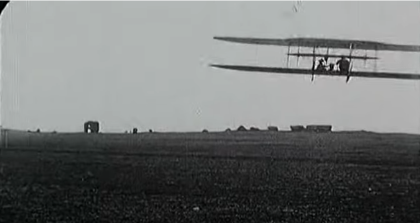
A scene from Wilbur Wright und seine Flugmaschine (1909). The film features the first aerial footage taken from an airplane.
Aerial photography on film taken from airplanes was the norm until 1972 when NASA launched Landsat 1 - the first satellite dedicated to earth observation.
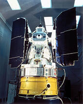
Landsat 1 and the first photograph from space.
According to the United Nations Office for Outer Space Affairs - not to be confused with Trump’s Space Force - there are currently ~15,000 objects in space. It is becoming increasingly crowded up there and the challenge of dealing with ageing space-junk is a real concern. Who knows - maybe that could be a job for Space Force.
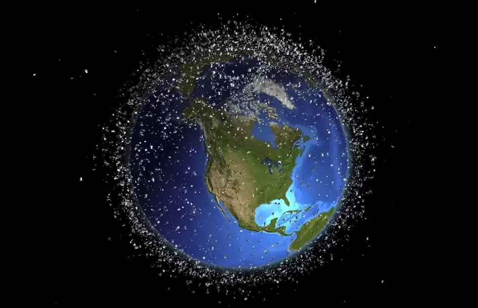
Time-lapse showing the growth of objects in low earth orbit.
The Index of Objects Launched into Outer Space list ~500 earth observation satellites. It is difficult to know exactly what most of those satellites observe and most are not accessible. Of the few that are, most are prohibitively expensive commercial satellites. Only a handful are free and easily accessible.
Types of satellites
Earth observation (also sometimes referred to as remote sensing) satellites come in different flavours and, depending on their instrumentation, orbital distance and orientation, will be useful in some contexts and useless in others.
We can break down the information satellites provide into four main categories:
spatial, spectral, temporal and elevation information.
Spatial information
Spatial information is data about the Earth's surface features, their locations, and relationships across geographic space through various imaging and sensing technologies.
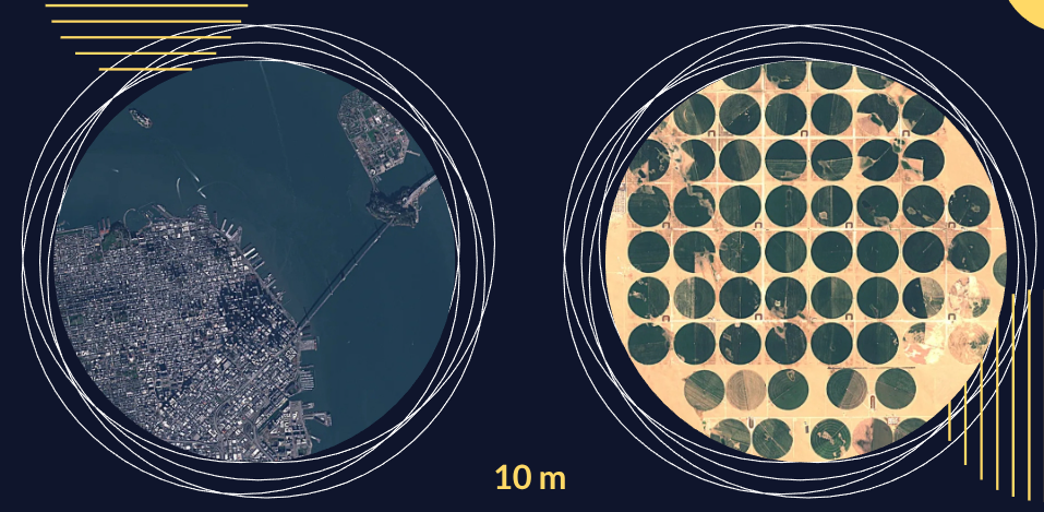
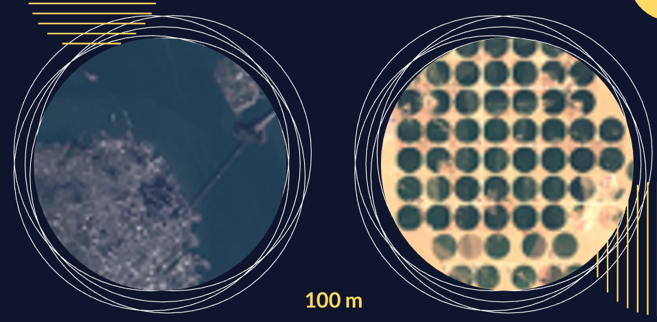
The quality and detail of a satellite image depends a lot on the spatial resolution of the instruments. We might for instance say that the Sentinel-2 satellite has a spatial resolution of 10m by which we mean that every pixel in the image is 10m. On a single satellite, different instruments might have different spatial resolutions.
Spatial resolution also depends on the orbital distance. The closer the satellite is to the surface, the higher the spatial resolution might be, but it will take longer to view the entire planet and the temporal resolution will be less.
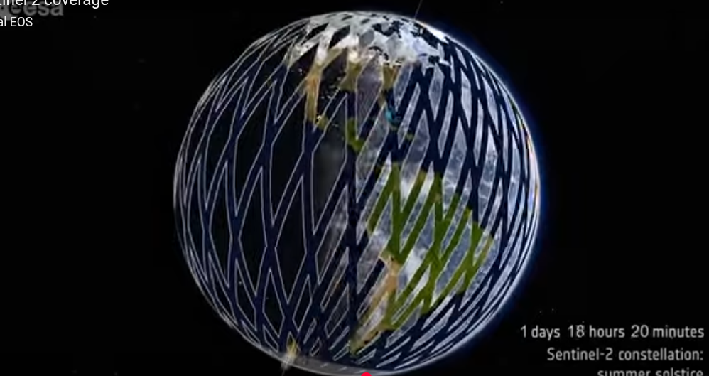
Sentinel-2’s complete coverage of the planet takes 5 days.
Spectral information
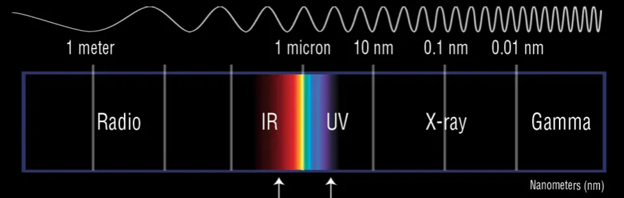
Spectral information is the data gathered from reflected electromagnetic radiation across different wavelengths of the electromagnetic spectrum.
What we normally see is only a fraction of the electromagnetic spectrum. When light hits a surface some of it is reflected as visible light but much falls beyond our modest human abilities. Satellites are designed to detect the broader spectrum of reflected light.
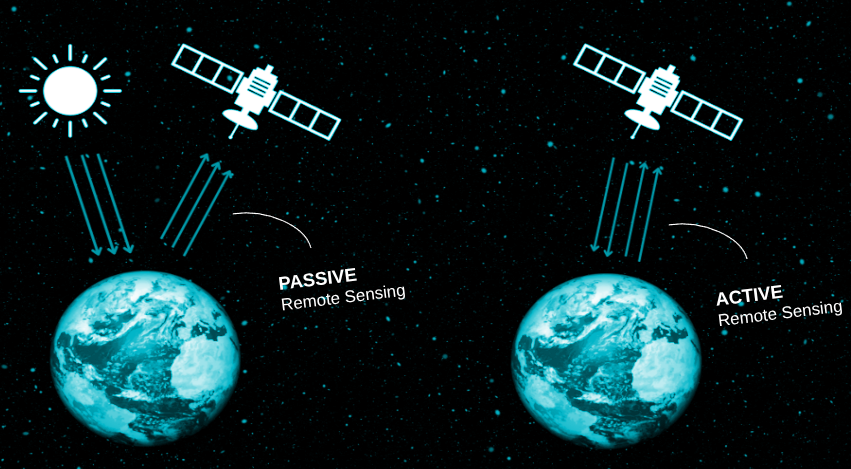
It is also useful to note that some satellites are passive and only detect reflected light. Other satellites are active and send out their own radar signal that they can then measure the response to. Passive satellites are often useless on a cloudy day, while radar satellites can see through clouds and at night, but the images are harder to interpret.
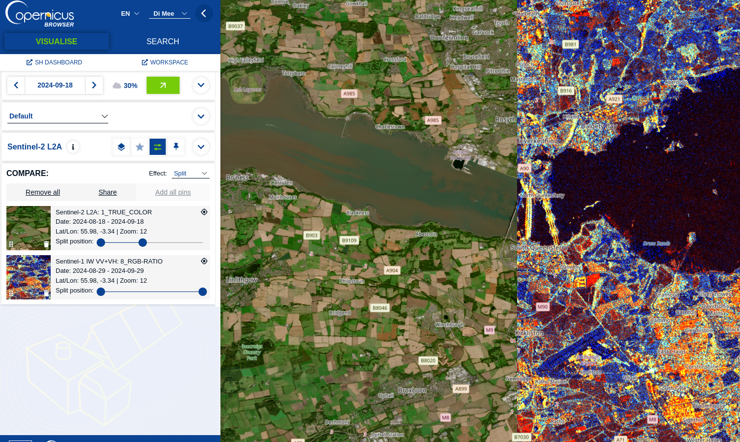
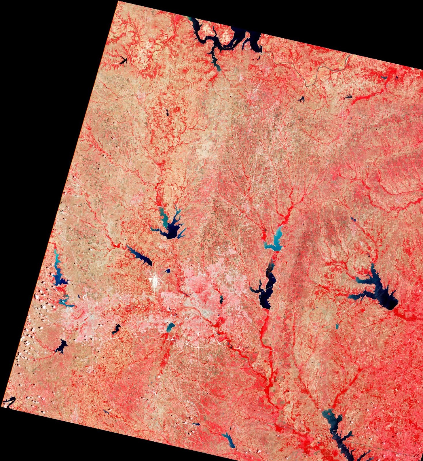
The same area in both optical true color and radar false colour
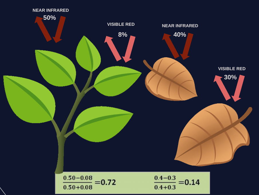
Different surfaces and chemicals reflect light in varying ways and this means we can for instance differentiate between healthy and unhealthy vegetation and urban areas and forests. This has proved very useful in understanding changing landcover and trends of urbanisation and deforestation.
Temporal information
By repeatedly observing the same geographic areas over time, satellites can detect changes on the surface and in the atmosphere. The temporal resolution depends on the orbital speed - essentially how long it takes the satellite to come back to the same spot and how long the satellite has been in orbit.
Landsat satellites are useful for historic comparison as the data goes back to 1972, while the Sentinel satellites have only been active since 2014.
Geostationary weather satellites like Meteosat sit far above the equator and orbit with the earth. This means they can view large areas in real-time, but the detail is poor.
Elevation information
Using active sensing, satellites can emit and detect radio (radar) or laser (lidar) and measure the returning signal and consequently the distance from the satellite. This means satellites can detect the height of mountains and hills, but also, increasingly, the height of individual trees.

When looking for useful satellite imagery and information, it is always a compromise and balance of these four categories.
From the image below, we can see that the higher the spatial temporal resolution, the higher the cost.
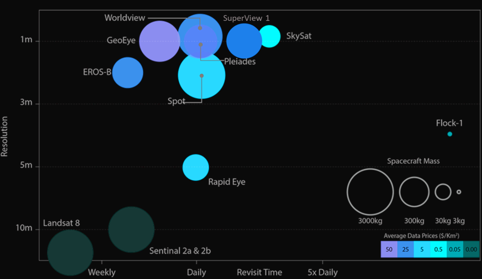
Spatial and temporal resolution and cost of some popular satellite imagery providers.
The free satellites
Luckily there are some satellites we can freely access and these can prove immensely useful in broadening our understanding of the world. It is useful to know what the satellites do and who operates them as this will inform the approach for our particular investigations and requirements.
While there are other satellites we can and should use, these are the most important ones:
Landsat Satellites
The original earth observing satellites. The first one was launched in 1972 and the programme is still ongoing with Landsat-8 recently activated. The Landsat satellites have both optical and radar instruments and are particularly useful for historic comparison. They allow us to see landscape changes since 1972.
Sentinel satellites
Sentinel-1 and Sentinel-2 were launched in 2014 and 2016 respectively and operated by the European Space Agency’s Copernicus programme. Sentinel-1 (A and B) are active radar satellites while sentinel-2 (A and B) are passive.
With a fairly high temporal resolution of just a few days, these satellites have been instrumental in disaster monitoring and change detection.
Aqua and Terra satellites
NASA’s Aqua and Terra satellites are both optical and radar and carry one of the most useful remote sensing instruments, MODIS, which is capable of taking photos, measuring surface temperature and monitoring air quality.
Weather satellites
Weather satellites like Meteosat and Emusat can be useful for live weather events, but also sometimes for the monitoring of active fires.
The state of EO access
Now that we have an idea of what we can potentially see, the question, of course, is where to access these images and data.
The truth is that while we now have potential access to an abundance of earth observation data and essentially have the world at our fingertips, it often feels like we’re wearing boxing gloves.
The data and tools are there, but they are not always intuitive and they are ever-changing.
For instance - a previous version of this toolkit would have included Sentinel Hub’s EO Browser as the first tool, but we’re not mentioning it in this toolkit. Changing licensing and a corporate takeover has ruined a once useful system and this, unfortunately, seems to be the case with many EO tools. It’s not that they are all going commercial, it’s just that, as an emerging field, they are continuously searching for a user-friendly and sustainable way to present their data.
Cover Photo by Raychel Sanner on Unsplash

.png)


